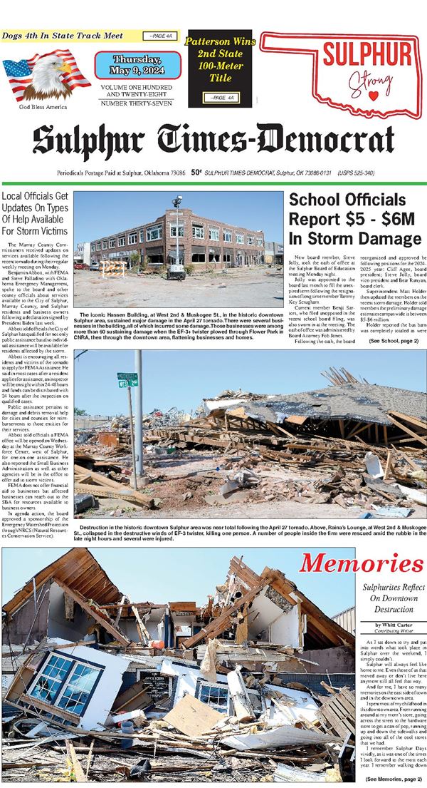

Sulphur Area Receives Nearly One-Third Of Yearly Rain In April
Copious amounts of rain over the last several weeks have filled ponds, pushed creeks and rivers out of their banks and caused flooding in low-lying areas.
Since April 1, the Sulphur area has received 11.18 inches of rain, nearly a third of the yearly average and there is more rain headed our way, possibly as much as three additional inches, forecasters said.
Major waterways including the Red River on the Okahoma-Texas border and the Washita River are flowing deep and wide, and contributing to a significant water rise on Lake Texoma. Currently, Lake Texoma is forecast to crest at 633.70 feet, about seven feet from the spillway. The lake has overflowed the spillway only five times in its decades’ long history.
The lake’s highest level came on June 1, 2015 with a record elevation of 645.72 feet, according to a report.
Closer to home, Lake of the Arbuckles is also up substantially, rising to 878.34 feet of elevation. That’s over six feet above the normal pool elevation of 872 feet of elevation.
According to figures from the Arbuckle Master Conservancy District, the lake has risen to about 45% of its flood control capacity (885 feet).
Due to soil saturation and the high rainfall totals in the last month, Arbuckle Master Conservancy District had ceased releasing water from the lake in an effort to minimize downtown flooding, according to Facebook post from Chickasaw National Recreation Area.
This could cause the lake to rise to higher levels if more rain is received.
At Chickasaw National Recreation Area, several areas were closed last week due to the high water.
They included:
•Catfish Bottoms
•Eagle Bay
•Buckbrush West
•Blackjack Road. Park officials indicated they would be monitoring all floodprone areas and will issue updated information as necessary.
SAMPLE BALLOT